Objective: To simulate the tsunami triggered by the December 26, 2004, Sumatra Earthquake and analyze its impact near a nuclear power plant on India's eastern coast. The study aimed to assess wave propagation, runup, and inundation in the region of interest to address the critical threat posed by tsunamis to coastal nuclear plants.
Solution: ACRi used its TIDAL® solver, which solves depth-averaged shallow water equations and incorporates advanced wetting/drying algorithms for accurate inundation modeling. The computational grid was refined with higher resolution in the areas requiring detailed analysis. Model simulations provided predictions of wave heights and water levels. These results were validated using data from tidal gauges, deep-water buoys, and observed onshore water heights.
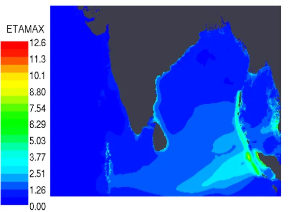
Outcome: The modeling successfully captured the key dynamics of the tsunami, including wave propagation, runup, and inundation near the nuclear power plant. The validation against observational and recorded data demonstrated the reliability and accuracy of the TIDAL® solver in simulating such critical events, providing essential insights for coastal hazard assessments. A contour plot of Tsunami Directivity, which is the maximum wave height (called ETAMAX here) recorded at every point during the duration of the tsunami, is shown below. It is useful to know where the energy of the tsunami was directed.